
So, I have to face facts: my favorite book in the world, as in, what I’d want on a desert island is “History In Asphalt“, an encyclopedia of 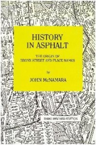 Bronx street names written by the late John McNamara. (All apologies to Shakespeare, Fitzgerald and Jesus Christ-Paul, John, etc. etc.) When you look at the Bronx around you, you see the Bronx around you. After spending time with this book, you can see the Bronx the way it is and the way it was. So, on a daily basis for now (maybe we’ll cut to weekly soon?) I want to take a street a day and give you the low down on its origin story, where the name come from. History in Asphalt is my favorite book and my favorite street in the United States, I’m pretty sure, is Eastchester Road. I was born “on it” at the Weiler Hospital, have lived a few blocks from it most of my life, and love its rich history, one of the oldest streets in the city. (Buy it here from the Bronx Museum of The Arts.) (Shoutout to reader Miriam Tabb.)
EASTCHESTER ROAD
“This ancient road is mentioned in the 1667 Nicoll’s grant of the Ten Fams as “the Westchester Path.” This was the earliest connecting road between Westchester and Eastchester. After the Revolutionary War, the term “Westchester Path” fell into disuse and Eastchester Road took its place. Before the days of the Oostdorp settlers (Dutch, pre-English) in what is today Westchester Square (where the Bronx Chronicle is located), it was a trail used by the Siwanoy”, (an Algonquin Native American tribe.) (Adam’s note: “Eastchester” began up by Dyre Avenue and extended all the way up to Scarsdale, until the City of Mount Vernon was “created” by real estate developers. To be clear, the road didn’t go all the way up through present day Mount Vernon; the border between Westchter and Eastchester proper was between Eastchester Rd. and Baychester Avenue by Boston Road.)
“Just below Pelham Parkway, the Americans had an outpost to prevent the British from crossing the shallow Westchester Creek in October, 1776.”(—Page 93) (So, about where the 49th Precinct is? The parking lot of the hospital over there, the low points, that was Westchester Creek about to turn into Stoney Brook, which cut through Pelham Gardens toward the current 5 train tracks through Fenton, Morgan, Seymour and Fish Avenues.
 Also just above Pelhamway Parkway in 1895, a map shows the word “Connersville” named after a small community of homes in the area, with one landowner being the Conners family I believe? (Pg. 342) The huge Givan estate was located off of Eastchester Road in the vicinity of the 10469 Post Office (a Givan home “pre street grid” can be seen behind it today, pictured at left, down the street from the Holy Rosary Parking lot.) Photo via Forgotten NY (check out their cool article on the area here.)
I could go on and on with more Eastchester Road lore and stuff. But I’ll leave it here for now. I think we will be doing Barnes Avenue tomorrow, so stay tuned.


Follow Us